File:Map of Athelaran.png
Jump to navigation
Jump to search

Size of this preview: 800 × 419 pixels. Other resolution: 1,223 × 640 pixels.
Original file (1,223 × 640 pixels, file size: 618 KB, MIME type: image/png)
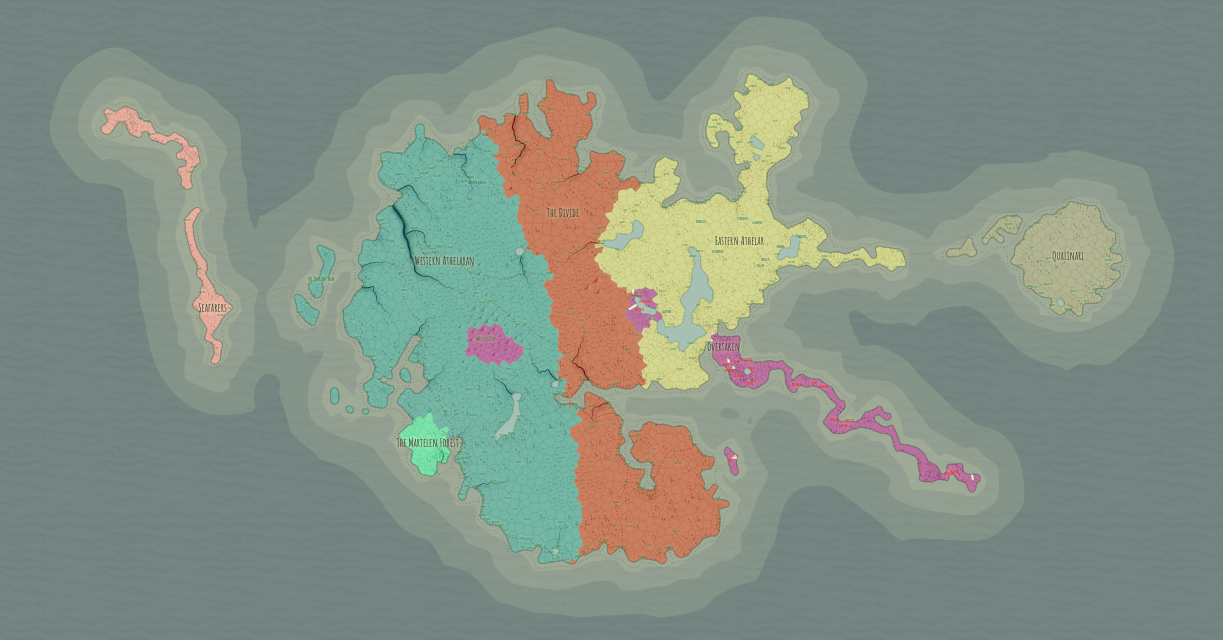
The Continent of Athelaran. The Western portion, which is coloured blue, is simply called Western Athelaran. The Eastern portion, coloured yellow, is simply called Eastern Athelaran. Off of the Eastern coast is an island called Qualinas, and it is where the Qualinari reside and originate from. Off the Western coast is an island containing the Dragons Maw, which is a sea fort shaped like a massive dragon, with the signal fire in the mouth always being lit.
File history
Click on a date/time to view the file as it appeared at that time.
| Date/Time | Thumbnail | Dimensions | User | Comment | |
|---|---|---|---|---|---|
| current | 11:26, 27 September 2019 | | 1,223 × 640 (618 KB) | NeophyteOne (talk | contribs) |
You cannot overwrite this file.
File usage
The following page uses this file: