File:InternaiMap.jpg
Jump to navigation
Jump to search


Size of this preview: 800 × 554 pixels. Other resolution: 879 × 609 pixels.
Original file (879 × 609 pixels, file size: 127 KB, MIME type: image/jpeg)
File history
Click on a date/time to view the file as it appeared at that time.
| Date/Time | Thumbnail | Dimensions | User | Comment | |
|---|---|---|---|---|---|
| current | 17:12, 18 January 2020 | | 879 × 609 (127 KB) | PapaGrrowler (talk | contribs) | Reverted to version as of 10:11, 18 January 2020 (MST) |
| 17:11, 18 January 2020 |  | 705 × 500 (232 KB) | PapaGrrowler (talk | contribs) | Reverted to version as of 01:06, 27 February 2015 (MST) | |
| 17:11, 18 January 2020 | 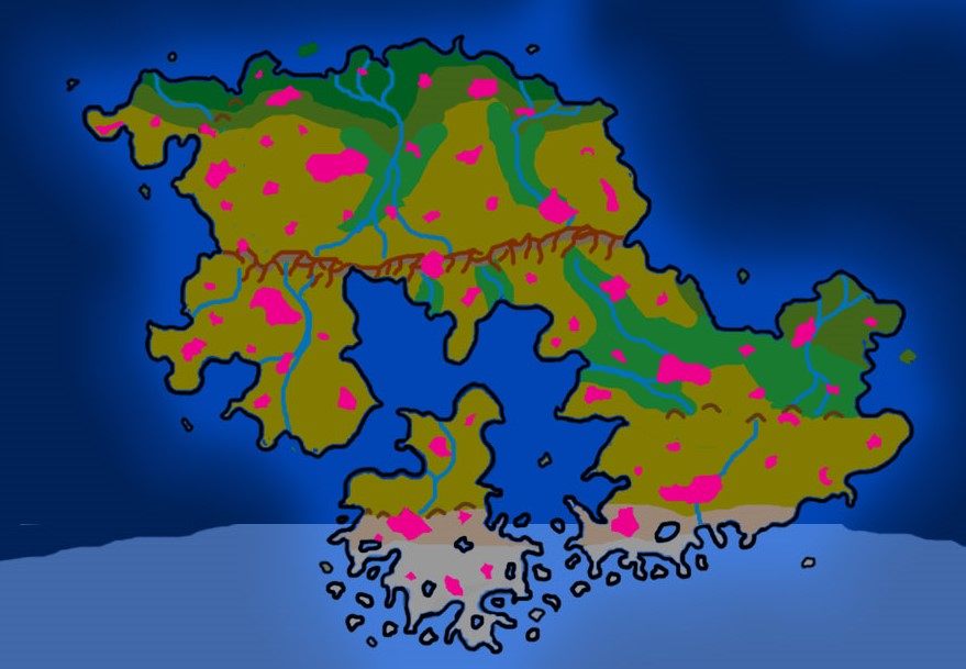 | 879 × 609 (127 KB) | PapaGrrowler (talk | contribs) | Time to update continental maps to match the Global map. | |
| 08:06, 27 February 2015 | 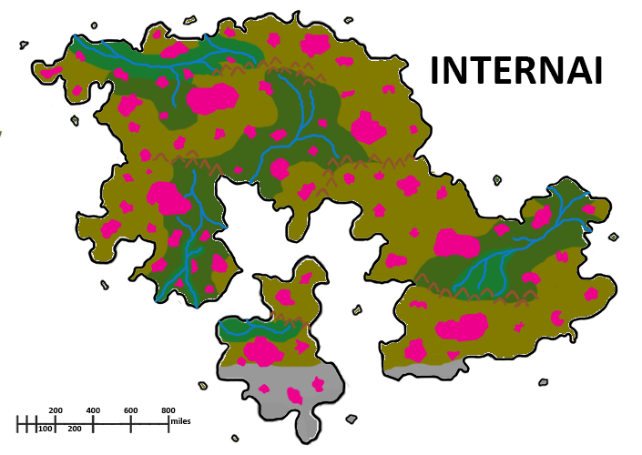 | 705 × 500 (232 KB) | Lemiel14n3 (talk | contribs) | ||
| 03:58, 19 January 2015 | 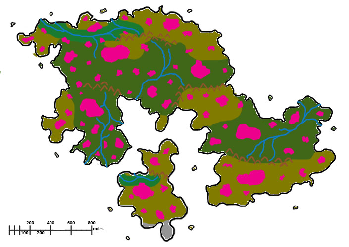 | 705 × 500 (98 KB) | Lemiel14n3 (talk | contribs) |
You cannot overwrite this file.
File usage
The following page uses this file: