File:Drudlein (World Map).jpg
Jump to navigation
Jump to search

Size of this preview: 800 × 600 pixels. Other resolution: 1,024 × 768 pixels.
Original file (1,024 × 768 pixels, file size: 762 KB, MIME type: image/jpeg)
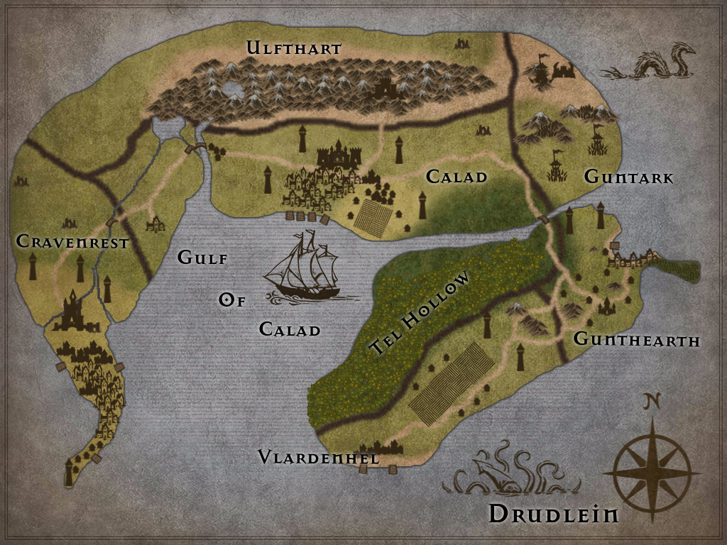
Drudlein World Map (created by me at inkarnate.com):
The multi-racial, port city of Calad and outlying settlements
Magically concealed forest of Drow mages: Tel Hollow
The coastal farmlands of Vlardenhel
Barbarian plains of Gunthearth
Arid desert wastes of Guntark, inhabited by Orc tribes
Dwarven citadel Ulfthart, located in the Ulfthart Mountain Range
Elven realm of Cravenrest; home to Drudlein's capitol, Argus (City of Glass: the Royal Family castle is made entirely out of Platinum)
File history
Click on a date/time to view the file as it appeared at that time.
| Date/Time | Thumbnail | Dimensions | User | Comment | |
|---|---|---|---|---|---|
| current | 06:37, 19 September 2015 | | 1,024 × 768 (762 KB) | Nomad0311 (talk | contribs) | Drudlein World Map (created by me at inkarnate.com): The multi-racial, port city of Calad and outlying settlements Magically concealed forest of Drow mages: Tel Hollow The coastal farmlands of Vlardenhel Barbarian plains of Gunthearth Arid desert... |
You cannot overwrite this file.
File usage
There are no pages that use this file.
.jpg&oldid=723740)