File:Americana.JPG
Original file (1,280 × 931 pixels, file size: 217 KB, MIME type: image/jpeg)
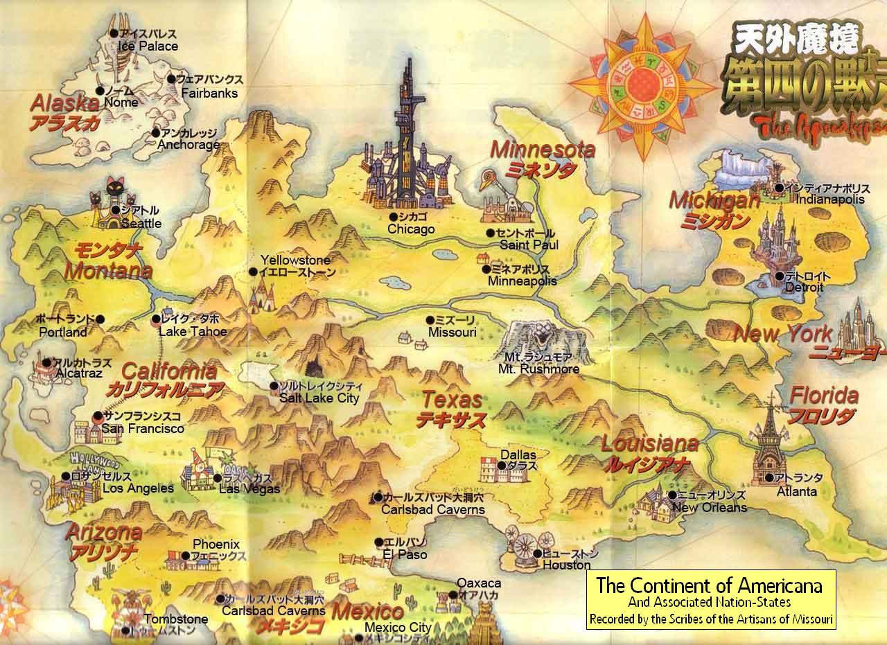
The big- VERY big- map of the Continent of Americana, as drawn by the explorer Phillip Hermanson. Accuracy is by no means guaranteed. Displayed are Nation-State capitols, certain landmarks, some rivers, and the general shoreline. Alaska representation is almost entirely speculation.
This is a modified version of another image whose original source I have been unable to locate. The unmodified version was posted on the 4chan imageboard with no source given. I include this image only due to its central importance to the Americana setting.
Back to Main Page → 4e Homebrew → Maps → Continental Maps
Back to Main Page → 3.5e Homebrew → Maps → Continental Maps
Back to Main Page → D20 Modern → Maps → Continental Maps
File history
Click on a date/time to view the file as it appeared at that time.
| Date/Time | Thumbnail | Dimensions | User | Comment | |
|---|---|---|---|---|---|
| current | 01:44, 28 May 2012 | | 1,280 × 931 (217 KB) | Maintenance script (talk | contribs) | Importing from media.dandwiki.com |
You cannot overwrite this file.
File usage
The following 2 pages use this file: