File:Blackthorn's Map 1.png
From D&D Wiki
Size of this preview: 800 × 600 pixels. Other resolutions: 320 × 240 pixels | 1,024 × 768 pixels.
Original file (1,024 × 768 pixels, file size: 1.48 MB, MIME type: image/png)
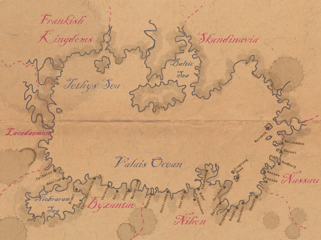
This is an overview of the kingdoms around the Valais Ocean, as drawn by the notorious pirate Blackthorn. There is no compass rosette, as this (flat) world has no magnetic field.
Back to Main Page → 4e Homebrew → Maps → Continental Maps
Back to Main Page → 3.5e Homebrew → Maps → Continental Maps
Back to Main Page → D20 Modern → Maps → Continental Maps
File history
Click on a date/time to view the file as it appeared at that time.
| Date/Time | Thumbnail | Dimensions | User | Comment | |
|---|---|---|---|---|---|
| current | 17:31, 27 May 2012 | | 1,024 × 768 (1.48 MB) | Maintenance script (talk) | Importing from media.dandwiki.com |
You cannot overwrite this file.
File usage
The following 2 pages use this file: